Where Were the Hills?
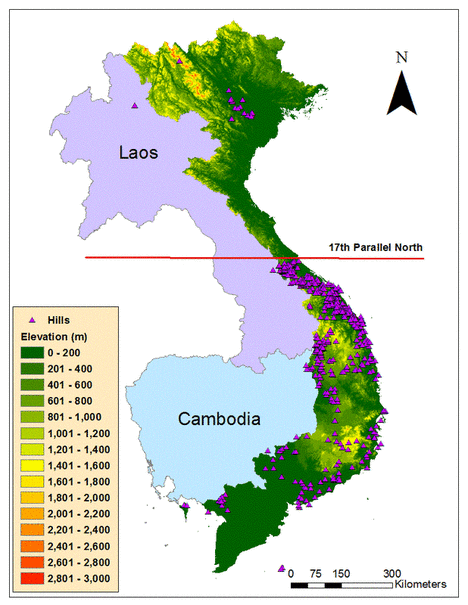
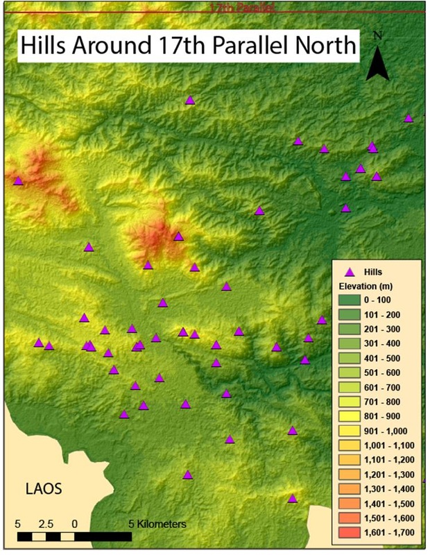
Hill coordinate data was derived from the book Where We Were in Vietnam which resulted in 618 hills geocoded to their location in Vietnam. It is suggested that most of the hills received their numerical name based on the elevation, in meters, referenced by the topography on the Army maps. This seems to hold true by looking at the location of a particular hill in relation to the surrounding topography on the map. This is actually a very useful bit of information since it gives the reader an automatic sense of the elevation ranges of the hills.
The resulting map shows certain spatial patterns of where the hills were located evident by clustering in certain regions. There is a large cluster of hills focused right along the border that separated North and South Vietnam (17th Parallel) which makes sense since this was a very active area since the Northern Vietnam Army (NVA) was trying to invade South Vietnam and overthrow their government. The “Hill Fights”, or the battle of Khe Sanh was located in this region right along the Ho Chi Minh Trail which became a very publicized event of the war. There is also a large clustering along the South Central Coast and also in the Central Highlands, aptly named for the changing topography in this region. The infamous battle of Dak To, or Hill 875, was located in the Central Highlands region near the border of Laos. There are some hills spread out along the Southeast and partially in the Mekong River Delta as well near where the battles of An Loc, Xuan Loc, and Saigon took place. Also, in the Northeast region, there is a small dispersion of hills located near the Northern Vietnamese capital of Hanoi.